The Trans Catalina Trail and the Cowboy-Hippies


This weekend I fell in love, and her name was Catalina...
You've heard of the Channel Islands off the coast of California, you probably have heard of Santa Catalina Island as well, but have you heard of the Trans Catalina Trail?
The Trans Catalina Trail, or TRT as it's called, is a 38.5 mile trek across Santa Catalina, from Avalon in the Southeast to Two Harbors in the Northwest. It is, in my experience, the purest way to experience Santa Catalina and to engage with the local nature. And in terms of Southern California hikes, this one was high on my bucket list.
Maybe ten years ago, I went to Catalina for the first time, and I was told of these people who would hike it. They were wild, adventurous people, who I heard hung out by the far reaches of Two Harbors and traveled for miles each day. Many of them we saw on the boat, covered in dirt with big smiles on their faces and carrying packs bigger than me. In my young perspective, they seemed like cowboy-hippies: rugged, strong, a little crazy, happy and free. How could anyone hike the length of this island with a pack that big?
And then I got really into hiking. And then I got into backpacking. And then I hiked the TRT and became one of those cowboy-hippies. And then I understood.
This is the story of that journey, from the spark of the plan to the journey of the experience. Contained within it is the perspective of a new backpacker and the many things I saw and did along the way, including the myriad things I learned.

Pre-hike:
The plan started in the spring of 2026, when I knew I had to do something awesome in the summer. The TRT seemed perfect, a shorter backpacking trip close to home with many nearby resources and the ocean to swim in. I couldn't wait, so I didn't. I started researching the climate, the elevation, backpacking gear, etc. It had been years since I had done an overnight hiking excursion and actually slept, so I had to figure basic things

out like what shelter could I use to sleep at night and how would I carry all my food for four days without it spoiling. Along with my siblings and some friends, I went out and bought the missing pieces of my kit, including a tent, a sleeping pad, a pillow, and a stove, all of which turned out to be worthy investments. Then, using a friend's spreadsheet which I adapted, I weighed everything, make a mock meal plan to determine how many calories I would consume each day, and determined how much water I would need to carry given the heat and elevation.
I also started to plan the direction of the route, which I decided I wanted to do from Avalon to Two Harbors, and with that the sections I wanted to split it into along with the campsites required for me to do so. By early summer, I had booked the campsites, the ferry, and gotten the hiking permit for me and my buddy. The trip was starting to take shape. In the end, I decided to break the trail into four hiking days, each adjusted for relative elevation and predicted fatigue, and I did so with the help of the Island Conservancy camping office (who I highly recommend calling) and the map located below.

Also, because I knew I wanted to do a couple backpacking trips this summer, I decided to test out my gear on an overnight trip, which you can read about here. Alongside the preparation of my gear, I further wanted to prepare my body, so I started doing rucks up hills. Usually, this just involved filling a backpack with bricks and hiking up steeper trails like the Chumash Trail or Mesa Peak Motorway. I started walking around my neighborhood with trekking poles because my tent required them, and I further incorporated them into my rucks and other hikes, including my hike of San Jacinto.
Was it overkill? Probably. But I was obsessed. And the obsession paid off, because when I hiked the TRT, not only was my body strong, but almost every part of my gear was finely tuned for efficiency and comfort. I am proud to say I never ran out of water, I never got a blister, and not once did I wake up with my legs feeling sore.

Day 1:
The first day involved getting to Catalina and making our way to Black Jack Campground. So, early in the morning before it was light, we woke up and carpooled to the ferry station in San Pedro, then hopped on the boat.
It was quiet, peaceful, and yet the air was filled with the anticipation of what was to come. It was also filled with the unceremonious groans of a dozen seasick passengers, because that boat was swaying. In my work, I have seen many a gross thing and a fair number of people discard the contents of their stomaches, and yet even I was starting to feel it. Maybe if we had gone outside it would have been better? But judging from the sounds coming from the aft of the ship that wouldn't have helped much. Finally, we depart of that boat and onto the dock, and at once we are met with a flurry of activity.
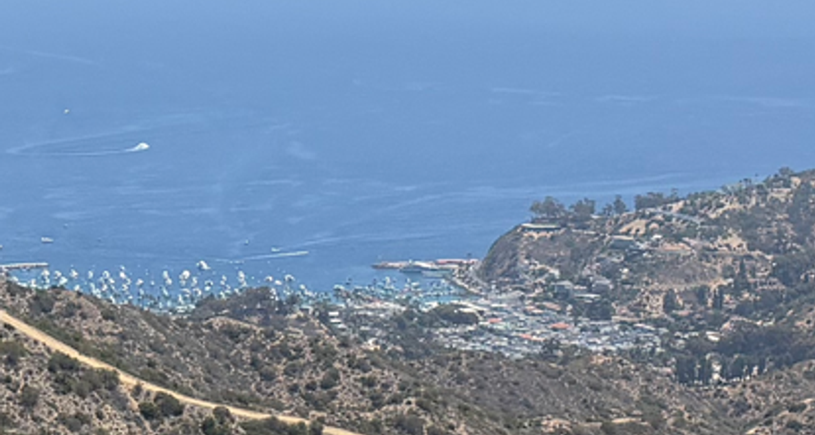
Avalon is smaller than I remember, and yet just as a full. Families walk briskly to catch their boat, kids run in every direction chasing who knows what, backpackers and divers shoulder their gear, and several scores of beachgoers enjoy the hot summer day or bathe in the cool tropical-looking water. In contrast to the nauseous rocking of the boat, the stark chaos is overwhelming, and yet welcome. It is kind of special, in its own way, because we know that soon we will be in an area with no people, where we are possibly the only humans for several miles and where the only chatter is that of squirrels.
We shuffle to join the throngs of people and quickly get lost in a group making its way towards the town's center. We don't exactly know where we're going, but we know the trail is on the side of the town opposite the beach, so we start to go that way. Also, we are fiendishly hungry, so we stop by a local galley to fill up on a couple burritos and we chat with some other tourists while we're at it. Mmwa! The food is delicious. Then, we walk deeper into town.
Within only a couple blocks the bustle quiets down immensely, and we are greeted with older homes and single lane road. It brings us by a golf course, a farm, a football field, and then finally a campground, which we later realize is Hermit Gulch. There we spot a baby deer and its mother, scrounging among the leaves and completely unbothered by our presence. At the far end of the space, we find the start of the trail, or should I say, the only trail. It is unassuming, sneaking behind a tree, and marked with a sign that says "Trans Catalina Trail," the like of which we will soon grow used to.

Finally, the real adventure starts, and boy does it get us into shape. The time is probably around 10:30, the sun's out, and the trail starts to climb. And it keeps climbing, and keeps climbing, as sweat pours down my body like an unrelenting shower. The heat is oppressive, and uncomfortable, and with little shade there is little respite even when we do stop to catch our breath. At last, we reach a waypoint with some shade and benches to rest. Here we meet a man and his daughter on the tail end of their journey, who tell us what we can expect going forward. I ask him if it's all down-hill from here, and he just chuckles. Uh oh. Also, it is here we meet three girls roughly our age, who set out ahead of us as we stop to eat our lunch.

Soon enough, we're off, and we quickly catch up to the girls. We hike with them for a bit, chatting about the hike and where we're from. At this point we are on the high plateaus, and we start to have expansive views of the ocean and surrounding island as we meander gradually up and down. That is, when we aren't trying to avoid the massive piles of bison dung that litter the trail. However big you think they are, trust me they're bigger.
Then, as we approach a park and a smaller pond, I see it! A bison! It's standing by the water, drinking and hanging out. The trail points directly towards it, and as we get closer I am not too keen to keep walking in that direction. The thing is massive, a beast, maybe two tons of muscle and fat, a cow on steroids, with a little afro and gnarly looking horns. My picture doesn't do it justice. We veer off to the right towards the park, where we watch the animal from a bit of a distance alongside a tour jeep.

The tour-guide crackles on her speaker, "These animals can weigh up to eighteen hundred pounds, can run up to thirty five miles per hour, and can jump up to six feet in the air." We stand next to the vehicle as she continues, "It is crucially important that you stay inside the jeep at all times and do not get out for any reason, because these animals can be very dangerous if you are on foot. Just earlier this year someone in Yellowstone got seriously injured because they walked too close to a bison." We grin, then walk to a nearby picnic table with the girls to grab some more lunch.
The trail leading out of the rest stop, which if you are looking on the map is Haypress Recreation Area, leads right along the north side of the reservoir where the bison was hanging out. The trail goes up pretty sharply, so I was on the fence on whether to take it or find an alternate route giving the bison a wider berth. But my buddy just started walking on it, so I figured I may as well just follow him. We were extra quiet, and a little nervous because we couldn't see the bison through the bushes, but it didn't seem to care and we were off to the next section.

This part of the hike, per the elevation map, went up a hundred feet for about a half mile then down a hundred feet the next. It was serene, with no one around, but also quite hot, and we once again took many a undesired shower in sweat. Thankfully, with four liters of capacity and six if I really needed to push it, water was not an issue, and there existed many refill stations along the way.
Soon we arrived at a shade structure with a view of the campground and Black Jack Mountain, and within a couple miles we were there. It had been a long, hot day, so after setting up our tents, eating a little chow and saying hi to the girls who arrived a couple hours later, we hit the sack. Of our campsites, I enjoyed Black Jack. We didn't have a view of the ocean, but the higher elevation meant we still had a good view of the surrounding mountains, and for how the exposed the rest of the hike was Black Jack was surprisingly shady. There was potable water, bathrooms, a shower, and even a little rope swing. Surprisingly, besides the girls and one other bike-packer, we had the large campsite all to ourselves, and it made for a peaceful end to our first day.

Day 2:
Compared to Day 1, Day 2 was a lot easier and maybe the highlight of the trip. After sleeping for twelve-plus hours, we woke up, starting hiking without breakfast, and promptly got lost. Our navigation consisted of a paper version of the above map and backup gps on our phone, and even with these we went the wrong way. See, the map makes it seem like going from BlackJack to Airport in the Sky is a pretty straightforward hike, but the multitude of trail junctions makes it a bit confusing despite the abundant trail markers. It also likely had something to do with our hunger and sleepiness, but we ended up hiking along the trail that said it went to Middle Ranch and then one which said it went to Airport in the Sky. On google maps, these two roads are marked "Cape Canyon Trail" and "Mt. Orizaba Rd" respectively, but that is not what the trail markers said. In hindsight, I think "Airport in the Sky" was pointing in the direction which we had just came from, and, though I hesitate to say this, I wonder if one of the trail markers was wrong.
In any case, after hiking past a water tower we were confronted with a locked gate, so we turned back and turned left. We then consulted AllTrails, and eventually we found our way onto the correct trail. I will say it is easy to get turned around coming out of Black Jack, because on this section you aren't so much going West as you are going North. You kind of wrap clockwise around Black Jack mountain, and if you follow the main road out the campsite you need to turn right before eventually turning left. If you make that first right, you should see a very clear "Trans Catalina Trail" sign to turn off into, and of course keep looking for the trail and mileage markers.

For Day 2, this was the toughest section of the hike for me, even though it didn't have the most elevation, namely because it was hot and I was extremely hungry. It was fun though to go up and down through the valley's before seeing the airport and sucking it up to get to breakfast. Which, I will add, wasn't bad. I had about 3 liters of rootbeer, a burger and a salad, and we also had the chance to say hi to a black cat and use a nicer bathroom. This was the last time we saw the girls, and it was unfortunate we never saw them again, because they were nice (and respectfully, maybe a little cute).
On our way from the airport, we saw a plane land before walking along a ridge and down a long gradual decline toward Little Harbor. This area was so incredibly quiet it was unreal--I think we saw maybe two other people, and there was no obvious human development or noise nearby, just short gray meadows punctuated with cacti and shrubs. It reminded me a bit of the hike from Sandstone Peak to the Sycamore Canyon Fire Road, except that it was perhaps more beautiful, better kept, and more isolated. After resting at a little shade structure, we eventually strolled into Little Harbor Campground, where we ate some lunch and hid our packs.

Why did we hide our packs, you may ask? What inconspicuous mischievousness and clandestine business could two backpackers possibly be involved with? The ocean! The stuff on our backs was our lives and to lose it or have it stolen by birds or people would mean we would go hungry, so we took extra precautions. Then we hopped in the most crystal clear and warm water I have ever seen. It was like a swimming pool, except with natural cliff formations and waves hitting up against rocks. Time ceased to have meaning, and we swam for hours, jumping off the rocks and laughing with the local campers who cheered us on. Then a guy told us about a cliff jumping spot on the other side of the rock, one that went into Shark Harbor, and I went over there as my buddy jumped off that side. I was a little more hesitant, and chose not to jump over here where I didn't know the rocks underneath.

Afterward, we ate some lunch and got our picture taken by some more campers.
Then we packed up, and because I was feeling so fresh I decided to carry my bag shirtless, which turned out to be a bit of a fatal mistake. The next section was tough, but we were so rejuvenated from the water and rest that we shot up the hills. These bordered cliffs overlooking the West side of the island, and once again the rugged isolation was truly special, even though the climb wasn't easy. We pushed hard, only stopping once or twice, which turned my skin slick with sweat and made my hands start to slip off of my trekking poles. The awesome struggle of it made me work harder, and my friend and I fed off each other's energy until we made it to the top, 2 or 3 large climbs later. Beautiful.

From there we descended slowly into Two Harbors, our knees starting to protest beneath us. Once there, I put on a shirt, we smashed a couple of Cactus Coolers, and I got my second burger of the day, this one complemented with fries. Nothing has ever tasted so good. Then we went to the eastern side of Two Harbors to check out the water, but after sitting there for a bit we decided not to swim, mainly because we were just so tired. Maybe a mile later, and we were at our campsite, which was located in a beautiful hilly area overlooking the water. We promptly realized we had left a piece of our equipment at the other side of the harbors, and I took a nice afternoon run to get it and bring it back. At last, we could truly relax, and after setting up our tents and eating some more grub I sat on a rock overlooking the ocean and watching the sun set as my buddy nursed his sore knees.
With day two finished, we nestled into our sleeping backs and prepared our bodies for day three, when we would attempt the last of the great TRT climbs.

Day 3:
On our way down into Two Harbors, we had kept an eye on the Western Mountains which we knew we would ascend the next day, mostly because if you look at the elevation graph on the map you see that it is during this stretch from Two Harbors to Parson's Landing that the trail reaches its highest elevation and with the steepest incline. We were a bit intimidated, but also determined.

So early on day three, we made some food, stopped by the visitor's center for a locker code (that will make sense later), and started up the mountain. In contrast to previous sections, this part of the TRT consisted of big red-colored fire road that I swear never dipped below a forty-five percent incline. The road flew up the mountain, but so did we.
Allow me to brag a little bit here, because I don't really know how we did it, except that we were really really determined to get to the top. Despite stopping several times to catch our breath, we made it to the top in roughly twenty minutes. We absolutely trucked it, and I was pushing my body as hard as I had ever pushed it. Our legs burned, our sweat coated every inch of our bodies, and our breath came out hot and fast. It didn't help that I had gotten a raging sunburn the day before, so my pack felt like a literal cheese grader on my back as it slipped up and down. It was nice that it was a little bit cloudy, though the heat maintained its oppressiveness.

Eventually, we arrived at a rest station, and the trail become more like a trail and less like it road. It still went aggressively up and down a couple hills, but in no way like it had before, since we were now on the ridge line. The area looked nothing like the other side of the island, as the dirt was a beautiful red, punctuated by the blackened remains of plants and small shrubs, and we could see ocean on almost every side, both because we were so high and because we were approaching the very end of the island.

Then the trail descends, sometimes at an alarming gradient like the ascent, and this is where I was very thankful to have my trekking poles. Many people recommend them, and so will I, because the TRT contains few switchbacks. The trail doesn't mess around. It's impatient, stubborn, a little daring in places. Like are we really going to go straight down from here with no turns? If it was a ski slope it'd be a groomed black. If it was a tree it'd be a longleaf pine.
The good news about this section: it's only six miles. So quickly enough, we walk into Parson's Landing, a cute little campground on the beach. With the locker combo I grabbed earlier, we grabbed some firewood and two gallon's of water, since there isn't a spigot over here. I'd highly recommend getting this package when getting the campground. For around thirty dollars, the two gallons take a lot of the stress away and allow you to carry less water (and less weight), and the firewood is great to burn as you watch the sun go down.

We got there a little early, so we had a lot of time to lay on the beach and swim in the ocean, which was a bit rougher than at Two Harbors. There were definitely areas of the beach I would not have swam in because of pretty severe rip currents, and even the area I did required a bit of effort to navigate. When we first got there, my buddy had climbed a rock maybe a hundred yards from shore, and so when we both went out there later I wanted to see if I could too. My friend is a better swimmer than I am, though, and when we got out there I decided I didn't want to climb the rock with the waves crashing over it as they were. On our way back to shore, the waves pushed us around, and I had to remind myself to chill out

and work with the ocean not against it. To be clear, I have lots of experience swimming and in the ocean, but if my more experienced friend was not there it might have been a bit scary.
When I got to shore, I tried to stand up right away and walk in, but the waves weren't having it and they sucked me back in. Once I relaxed I was pretty easily able to walk/swim in with the waves, and this taught me a lot about working with the ocean.
In the late afternoon, we had a feast with some of our remaining food. Then we lit up the logs and told stories around the fire with a fellow camper, which was a ton of fun. I fell asleep to the soothing sound of waves, and this concluded Day 3.
Day 4:
Our final day in some ways presented a victory lap. There was no big mountain to climb or long mileage to hike, and the path hugged the ocean the entire way. It was a little confusing leaving Parson's landing, and we ended up just choosing an eastern trail that didn't lead to the beach. This took us up a hill and through some brush, at which point we saw a trail leading steeply up the overlooking bluff, which we decided to follow and then run up. We had to get our exercise in somehow.

As it turned out, the effort earned us a fantastic view, and we rode the cliff as the path climbed up and down along the ocean. We saw beautiful coves and more crystal clear water, so much so that we could see fish from over a hundred feet up along with the various kelp and other ocean flora. I wonder how many people have seen those areas, these untouched coves and perfect little sanctuaries for Pacific life. I hope, as long as I live, that those majestic homes never go away, and that those pockets of stunning ecosystems are never disturbed.
The trail continues like this, and I couldn't help but stop continually to snap pictures and take in the sights, both of that exquisite ocean and of the towering mountains which we could see floating above the clouds in the distance. I may try, but truly I cannot describe what can only be experienced.
Herein we somehow got lost once again. In fairness, we hadn't seen trail markers for some time, but one of our maps said this was the Trans Catalina Trail. In reality, I believe the true TRT ran along the wider fire road which we would join later, but we were not privy to this insight at the time. We passed a shooting range, and then, all of a sudden, we found ourselves in the middle of a large occupied area.

At first though, we weren't exactly sure if it was a camp or a little settlement, and the men we bumped into told us we could probably find a way out if we asked someone along the way. I wasn't concerned, that is, until I realized everyone had matching shirts and that there were far more kids than adults. Of course, this wasn't an issue for us; in some ways this was great, because we hadn't seen a trail marker for awhile and were at this point somehow lost. But having worked at a camp, I know the stress any stranger can bring to a controlled environment full of kids, and I didn't want to cause unneeded anxiety. So I wanted to leave as soon as we could. After looking at our maps, we walked along the central thoroughfare, trying to find a way to the main road which we knew would be our closest out and likely would direct us back to the TRT. At this point I spotted three stern looking individuals, who were eyeing us and looking rather in charge. I figured the best thing I could do was introduce myself and ask for help, and they were very happy to help us find a way out. I could tell of the man who helped us find the trail that he cared about the camp, and his demeanor was extremely helpful and friendly. On leaving, we saw a sign that said it was a private camp and that hikers should stay on the trail. That was a bit frustrating to me though because we didn't see any indication while we were on the previous trail that we were entering onto private property, and it wasn't a long enough section for us to be meaningfully worried about the lack of TRT signage. I think the lesson here is that I could have had a better backup map, and that I shouldn't have gone wandering onto a trail that did not have explicit signage. The views were great, but I would be careful in this section to not end up in the same situation we found ourselves. I suspect that while this is a potentially viable route to see the coastline, there exists an offshoot that me and my friend missed, which I would make sure to research and identify beforehand.

Besides this, the rest of the trail back to Two Harbors was beautiful if uneventful. We continued to see the bright blue water, and we passed by numerous other camps and private vacations spots. The only downside here was that the TRT traveled along a one lane dirt road, so we often had to stop for cars and trucks passing along the route. With almost no change in elevation, we soon made our way back to the same restaurant I had gotten a burger at the day before. And guess what I did? I got a burger of course. Delicious again, maybe even more so. My friend and I also bought a couple of sodas, and when all was said and done we calculated that we drank combined over a gallon of root beer. Yes, I said over a gallon: we each had five refills of a 22oz cup. Hopefully my liver survives.
Our boat did not leave for awhile, so we walked back over to Day 3's campsite, hid our bags (again, highly suspicious), and jumped in the water once more. Compared to Parson's, the water is much more calm at Two Harbors, and we had a fun time swimming and jumping off the surrounding rocks. Then we lay on the beach and dozed to the sounds of the surrounding life. Someone also told us we should be careful because there were biting flies in the sand, but we ignored them; we hadn't been bit yet! There's a kind of beauty to the ignorance of life's anxiety. Sure we could get bit, but then we would miss out on a killer rest. Sure we could worry about every part of the ocean, but then we would miss out on a great swim. Sure we could worry about not being on time for our boat, or about getting sunburned again, or about our packs in those bushes, but then we would miss out on a relaxing last few hours.

All good times come to an end though, and soon our boat arrived. We hopped on, said farewell to the island which had given us so much, and floated back towards the mainland. Along the way some people started singing their cultural Native American song which they said originated with their ancestors down in San Diego, and it was a quite fitting and calming backdrop to the lulling of the waves and spray of the sea. We also saw a whale, which I had never seen before, as it swam toward us and behind us, its small little dorsal fin and huge body breaching the crest of the waves.
All in all it was a fitting conclusion to an eventful trip which I hope someday to do again.
Conclusion:
This one had been on the bucket list for a long time, and I was so so so happy to have finally done it. From the first time I had seen the hikers, to my various friends who had hiked the TRT, I knew I had to go out and see Catalina for myself. And I was not let down.

I learned so much, about finding the right trail, about keeping myself from getting sunburned, about preparing the right food, about Catalina itself, about my friend, about the various people we met along the way, and I know I will keep these truths with me for a long time. For that I am lucky.
If I did it again I might try and do it in fewer days, maybe one or two for the challenge, or if I went with a bigger group or someone special I might want to hike into Little Harbor from Two Harbors and stay two or three nights. It's such a great little cove, I might even push four. I would also do the hike in the Spring or Winter, when the weather is milder and the foliage is more green. Catalina was so kind to me, both the people, the overall well-marked trail, and the stunning and yet accessible hike, and so I know at some point I will find myself back there.
I imagine I will be at a different stage of life; I imagine I may have different goals, maybe a different job, and yet I also imagine that no matter what I will enjoy it again as a cowboy-hippie, at once and forever free.


Comments